Hiking Holiday in Leogang – Your Perfect Starting Point at Salzburger Hof
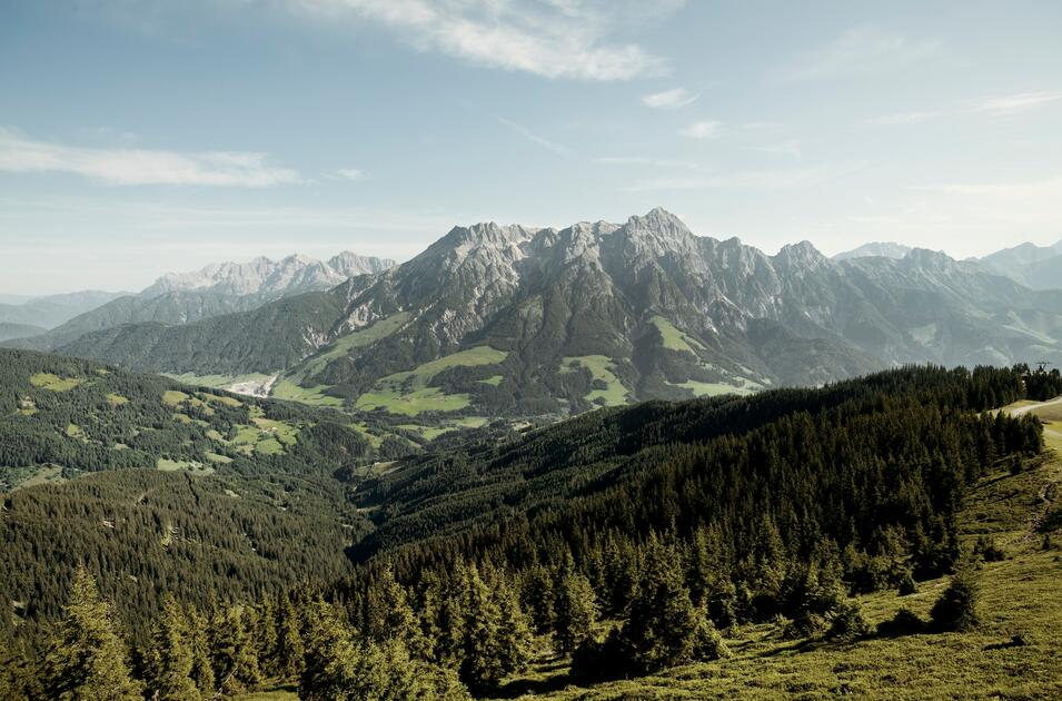
With its extensive network of hiking trails, the Saalfelden Leogang region is a great destination for walkers. The rugged Steinberge mountains to the north and the rolling Grasberge mountains to the south ensure fantastic views wherever you go. Well-signposted trails mean you won’t get lost while exploring blooming meadows, conquering summits or seeking out huts serving hearty local food. Enjoy mouth-watering alpine treats as you take in scenic views of glistening mountain lakes.
This diversity makes our region a popular destination for all kinds of hikers. Here, relaxation-seekers, nature-lovers and summit-climbers alike are sure to find what they are looking for. Need any tips for your hiking adventure? At the Salzburger Hof Leogang we are happy to share our knowledge of
With the Asitzbahn lift just 99 metres away, the Salzburger Hof Leogang is the ideal starting point for all sorts of hikes, from gentle walks to mountain climbs.

Saalfelden Leogang is one of the most expansive and diverse hiking regions in the Alps. The Leoganger Steinberge limestone mountains and the gently rolling hills of the Grasberge mountains provide interesting contrasts during your hiking adventures. All in all the region offers over 400 kilometres of walking and hiking trails.
Hiker's paradise Saalfelden Leogang
This family-friendly circular walk has some beautiful views. The highlight is the Einsiedelei Saalfelden, a hermitage overlooking Saalfelden. This fascinating place impresses children and adults alike. Located slightly above Schloss Lichtenberg castle, the hermitage and its tiny chapel appear to be carved into the mountain. Built in the 17th century, it remains one of Europe’s last remaining occupied hermitages.
Directions
The starting point for this hike is the Bürgerau-Saalfelden car park. Take the footpath across a little bridge to Schloss Lichtenberg castle, which was first documented in 1281. Continue through the woods up to the hermitage. Wooden stairs and platforms provide access to the individual buildings and scenic views of Saalfelden. Once you’re done exploring, continue to Bachwinkel, where an easy footpath leads back to the starting point. The circular walk takes approximately 1.5 hours to complete.
This hike is a real classic and equally popular with locals and tourists. The destination is the Peter-Wiechenthaler-Hütte mountain hut, owned by the Austrian Alpine Association, which offers fantastic views of the Salzburg mountains. The hut is not only popular for its sunny terrace but is also an important base for mountaineers keen to climb the nearby summits as well as long-distance hikers journeying across the Alps. The hut can either be reached via a regular footpath or by taking a detour via the Jägersteig path. The latter is for experienced hikers and mountaineers only.
Directions
The hike begins at the Bachwinkel car park in Saalfelden. Follow the signposted path through a thick forest, followed by some more difficult, rocky terrain. On sunny days, the heat makes this section across the rocks extremely strenuous, so don’t forget to bring sun cream and plenty of water. Continue along the path until you reach the hut. Here, take a moment to savour the spectacular 360-degree view, catch your breath and sample some of the local food. Once you’re recovered from the 2.5-hour ascent, make your way back into the valley.
There’s an alternative route to the hut for experienced hikers who are sure-footed and have a good head for heights. Half-way up, leave the regular footpath and take the demanding Jägersteig path. Allow 5.5 hours if you plan on taking this route and be prepared for a real challenge.
This hike takes you on a geological journey of discovery to the Birnbachloch, the 20-metre-wide entrance to a karstic spring. The shimmering, crystal-clear waters of the spring are like an untouched lake. Researchers believe the spring stems from an underground lake that could be a part of a vast hidden system of caves. Just a few hundred metres further you will find the Birnbachlochgletscher glacier, Central Europe’s lowest glacier.
Directions
The hike begins at the Steinbergstadion football pitch in Leogang. Follow the path through the Wetzsteinwald forest to the Leoganger Ullachtal valley car park. From there, the trail crosses a dried-up stream and lush meadows to the Passauer Hütte mountain hut. Follow the signposted trail to the northwest, leading you through rocky terrain that becomes more and more barren. The mountain pines growing on the limestone give this environment its distinct, rugged character. Shortly before you arrive at the Birnbachloch, we recommend you stop to take in the impressive view of the Birnbachgletscher glacier. In the 19th century, beer brewers from Munich used the ice from the glacier to cool their beer cellars on hot summer days. The ice was transported hundreds of metres on wooden sleds down into the valley.
You can either take the same way back or choose a different, slightly more exposed, route back to Leogang, provided you aren’t scared of heights. Take the suspension bridge at the Unterstandshütte hut to the inn of Gasthof Priesteregg and continue onto the signposted path towards your starting point.
Explore the Saalfelden Leogang region and immerse yourself in this breathtaking natural environment.
Mountains are freedom!
Time to start your hiking adventure in Leogang's mountains.


